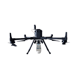

Drones at airports
Stratus, in partnership with ATTA'M Engenharia e Aerolevantamento, offers innovative topographic engineering solutions for airports. Through this partnership, we have already surveyed over 35 km² using drones, without causing any impact on airport operations. This technology allows us to precisely and efficiently meet airport demands, ensuring safety and agility in projects.
Stratus has been operating in the drone aerolevantamento sector at airports since 2018. In 2024, we achieved a historic milestone by completing, for the first time in Brazil, a full aerolevantamento of 2,700 hectares in just 3 days of operation. This achievement was made possible through our efficient coordination with the airport and air traffic control (ATC) agencies, ensuring the work was carried out with maximum safety and precision.
Services provided using drones at airports:
Engineering: planimetric and altimetric surveys with contour lines, DEM/DSM, point cloud. Inspection and monitoring of construction works and environmental areas, dimensioning of infrastructure elements (painting, runway rubber, counting, pavement analysis).
Operations: inspection of runway systems (PPD, aprons, taxiways), runway strip, RESA, development of the PBZPA (Airport Emergency Plan).
Safety/Security: automated asset and operational security, thermal cameras, and scheduled flights.


